
QuartieriDistrictsQuartiere
RovioRovioRovio
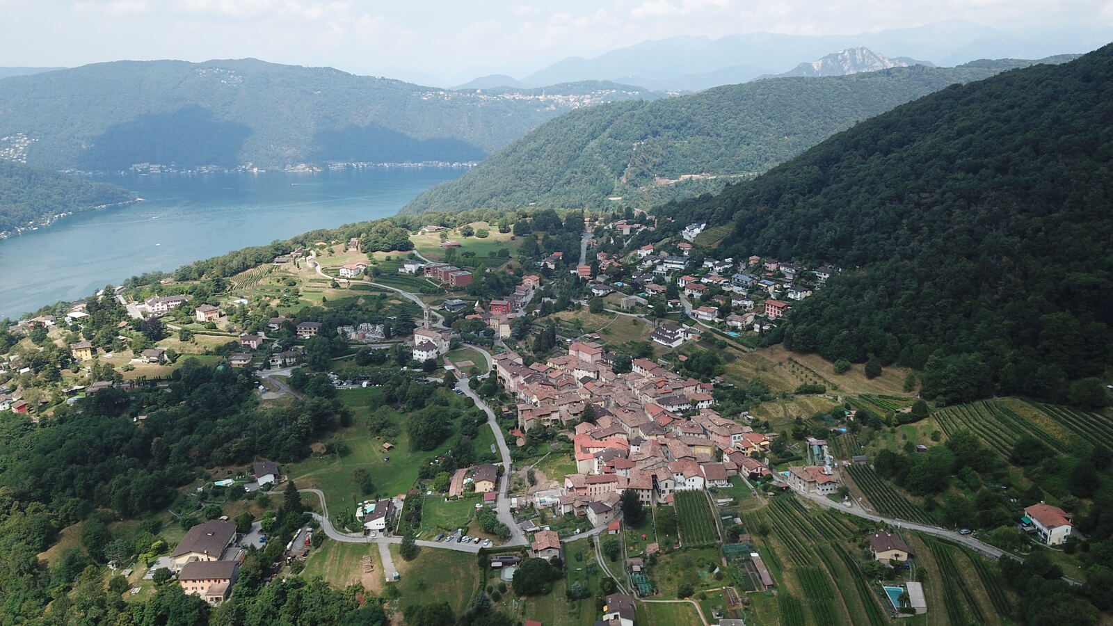
Da vedereHighlightsSehenswert
Luoghi del quartierePlaces in the districtOrte im Quartier
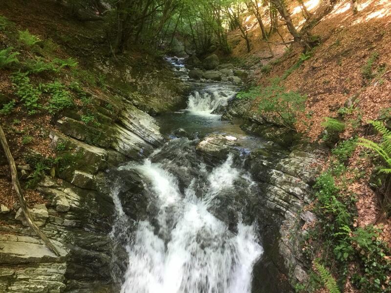
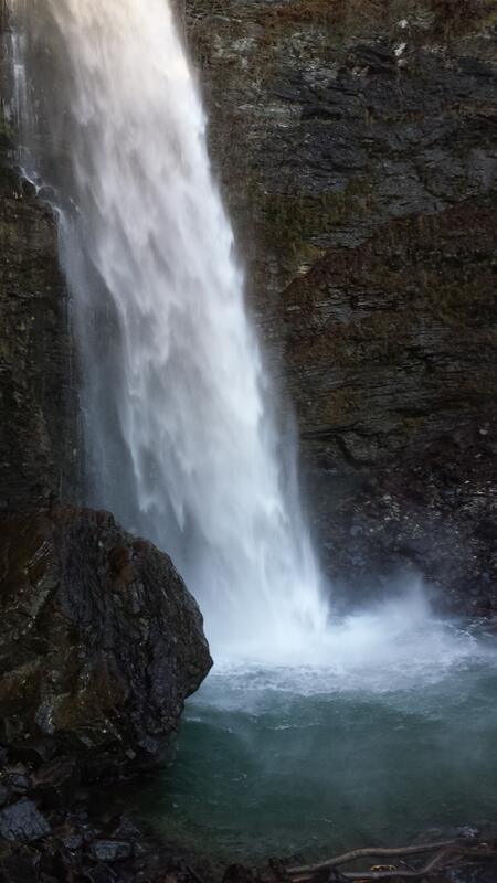 Cascata del BottoBotto waterfallWasserfall del BottoRovioRovioRovio
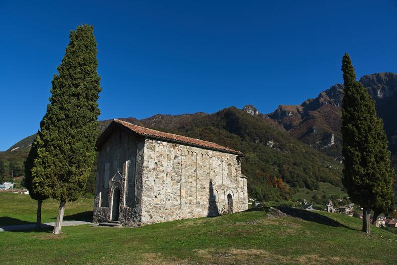 Chiesa di San VigilioChurch of San VigilioKirche San VigilioRovioRovioRovio
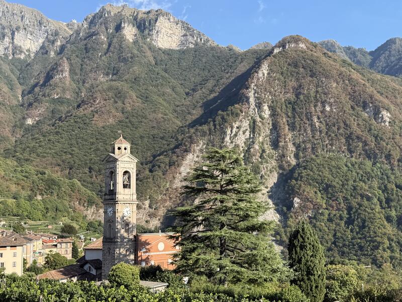 Chiesa Santi Vitale e AgataChurch of Sts Vitale and AgataKirche St. Vitale und AgataRovioRovioRovio
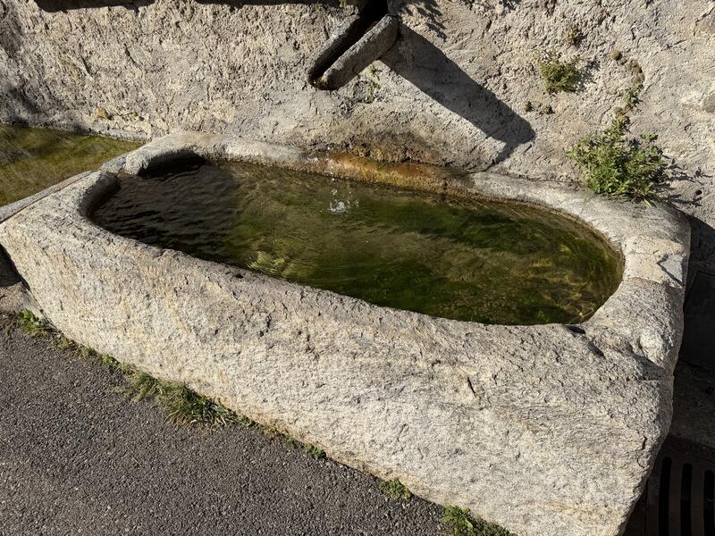 Fontane dei Sarcofagi RomaniRoman sarcophagus fountainsBrunnen mit römischen SarkophagenRovioRovioRovio
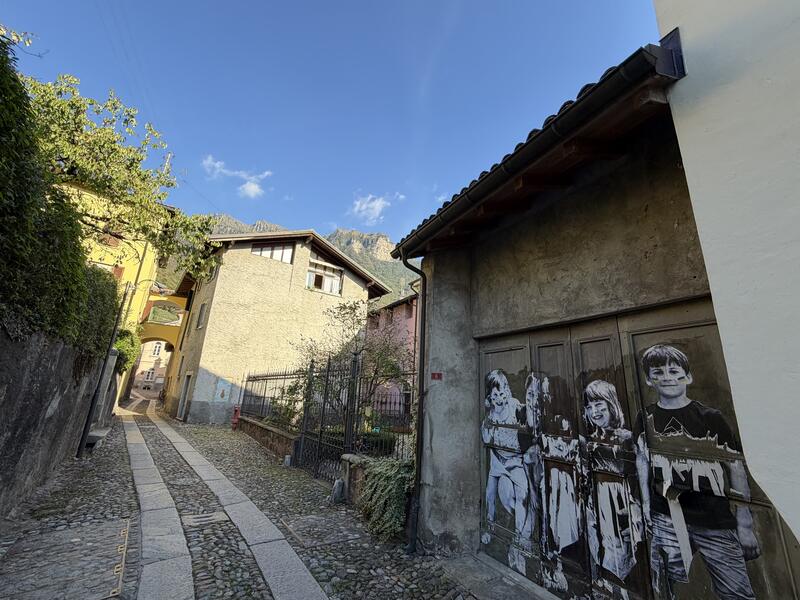 Il NucleoThe historic centreDer OrtskernRovioRovioRovio
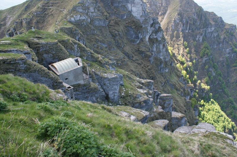 La Ca’ da la MataLa Ca’ da la MataLa Ca’ da la MataRovioRovioRovio
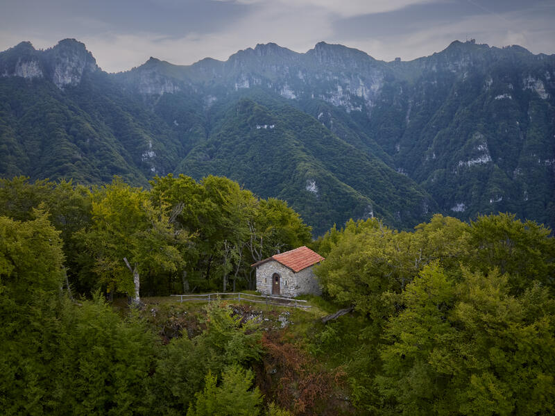 Oratorio di Sant'AgataSt Agatha's OratoryOratorium St. AgathaRovioRovioRovio
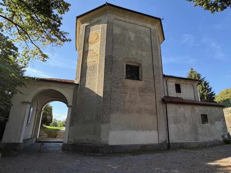 Oratorio Madonna del CarmeloOratory Madonna del CarmeloOratorium Madonna del CarmeloRovioRovioRovio
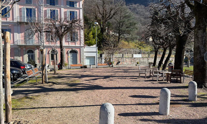 Piazza FontanaPiazza FontanaPiazza FontanaRovioRovioRovio
 SovagliaSovagliaSovagliaRovioRovioRovio
Apri la mappa del quartiereOpen the district mapQuartierkarte öffnen
Nella storia…
Rovio gode di una situazione privilegiata, una magnifica vista sul Lago di Lugano e un retroterra che si spinge fino alla vetta del Monte Generoso caratterizzato da una rigogliosa vegetazione. La sua posizione e lo stretto legame con le vie di transito per l’Intelvese, hanno fatto sì che l’area venisse occupata sin dall’antichità, come testimoniano i ritrovamenti archeologici dell’età del ferro effettuati sulla strada per Arogno nel 1846 e i diversi avelli romani, riutilizzati quali vasche delle fontane che si possono osservare nei vicoli del nucleo.
Nell’alto medioevo Rovio apparteneva alla giurisdizione di Castelseprio e proprietà private “in illa de Rovi” sono menzionate a partire dall’852, periodo al quale potrebbe risalire la costruzione dei primi edifici religiosi.
Ad un’economia prevalentemente agricola, legata alla campicoltura, alla viticoltura, all’allevamento e alla produzione di carbone di legna, si affiancò l’emigrazione di maestranze edilizie ed artistiche. Intere famiglie, per generazioni, furono attive nell’intera Europa, da Londra a Roma: sono i Bagutti, i Carlone, i Galli, i Manni ed i Mazzetti che hanno arricchito anche il villaggio natale di notevoli opere.
Grazie ad un’intelligente politica locale il marcato sviluppo residenziale, iniziato a partire dagli anni 1960-1970, non ha intaccato il prezioso equilibrio del nucleo storico dove, su piazze e vicoli ancora selciati, si affacciano pregevoli edifici: in Piazza Fontana il tardo-neoclassico Palazzo Bagutti, costruito nel 1864, con numerose stanze decorate da dipinti ottocenteschi; il gruppo di case in Via Generoso, gli affreschi raffiguranti la Sacra Sindone, una Madonna con santi e Sant’Antonio da Padova; Casa Vassalli, con affresco della Fuga in Egitto della prima metà del XVIII secolo; Casa Groppi, in Riaasòtt, con bassorilievo della Madonna col bambino di Domenico Bagutti (1784-1831); in Piazza dal Torc la Casa Carlone, il cui salone fu affrescato da Giovanni Carlone tra il 1695 e il 1700.
A part of history…
Rovio is favourably situated, enjoying magnificent views of Lake Lugano and a backdrop stretching to the peak of Mount Generoso characterised by lush vegetation. Its location and its proximity to the transit routes through the Intelvese area have meant that the area has been occupied since ancient times, as evidenced by the archaeological finds from the Iron Age discovered on the road to Arogno in 1846 as well as various Roman tombs, which were reused as baths at the fountains that can be seen in the streets of the town centre.
During the Middle Ages Rovio came under the jurisdiction of Castelseprio and there are mentions of private property “in illa de Rovi” as early as 852, a period which could date the construction of the first religious buildings.
Added to the predominantly agricultural economy, associated with field crop cultivation, viticulture, livestock and charcoal production, Rovio was the point of origin for a number of skilled builders and artists. Entire families were active throughout Europe for generations, from London to Rome: among them the Bagutti, the Carlone, the Gallis, the Manni and the Mazzetti, who enriched their native village with remarkable works.
Thanks to intelligent local policy, the residential development market, which began between 1960 and 1970, did not affect the precious balance of the old town where fine buildings look out over the squares and cobbled streets: the Piazza Fontana, the late-neoclassical Bagutti palace, built in 1864, with several rooms decorated with nineteenth-century paintings; the group of houses in Via Generoso; the frescoes of the Holy Shroud; a Madonna, accompanied by various saints, and St. Anthony of Padua; Vassalli House, with fresco of the Flight into Egypt from the first half of the eighteenth century; Casa Groppi, in Riaasòtt, with bas-relief of the Madonna and Child by Domenico Bagutti (1784-1831); Casa Carlone in the Piazza dal Torc, whose living room was painted by Giovanni Carlone between 1695 and 1700.
Aus der Geschichte …
Rovio geniesst eine privilegierte Lage: eine herrliche Aussicht auf den Luganersee und ein Hinterland, das bis zum Gipfel des Monte Generoso reicht und von üppiger Vegetation geprägt ist. Seine Lage und die enge Verbindung zu den Durchgangswegen ins Intelvi-Tal führten dazu, dass das Gebiet seit dem Altertum besiedelt war, wie die 1846 an der Strasse nach Arogno gemachten archäologischen Funde aus der Eisenzeit und die verschiedenen römischen Sarkophage zeigen, die als Brunnentröge wiederverwendet wurden und in den Gassen des Ortskerns zu sehen sind.
Im Frühmittelalter gehörte Rovio zur Gerichtsbarkeit von Castelseprio; Privatbesitz «in illa de Rovi» wird ab 852 erwähnt, eine Zeit, in die der Bau der ersten Kirchen fallen könnte.
Neben einer vorwiegend landwirtschaftlichen Wirtschaft – Ackerbau, Weinbau, Viehzucht und Herstellung von Holzkohle – stand die Auswanderung von Bauhandwerkern und Künstlern. Ganze Familien waren über Generationen in ganz Europa tätig, von London bis Rom: die Bagutti, Carlone, Galli, Manni und Mazzetti, die auch ihr Heimatdorf mit bedeutenden Werken bereicherten.
Dank einer klugen Gemeindepolitik hat die starke Wohnbauentwicklung, die in den Jahren 1960–1970 einsetzte, das kostbare Gleichgewicht des historischen Kerns nicht beeinträchtigt, wo an noch gepflasterten Plätzen und Gassen wertvolle Gebäude stehen: an der Piazza Fontana der spätklassizistische Palazzo Bagutti, 1864 erbaut, mit zahlreichen von Malereien des 19. Jahrhunderts geschmückten Räumen; die Häusergruppe an der Via Generoso mit den Fresken des Heiligen Grabtuchs, einer Madonna mit Heiligen und des heiligen Antonius von Padua; die Casa Vassalli mit einem Fresko der Flucht nach Ägypten aus der ersten Hälfte des 18. Jahrhunderts; die Casa Groppi in Riaasòtt mit einem Relief der Madonna mit Kind von Domenico Bagutti (1784–1831); an der Piazza dal Torc die Casa Carlone, deren Saal Giovanni Carlone zwischen 1695 und 1700 mit Fresken ausmalte.
Gli edifici religiosi
Chiesa dei Santi Vitale e Agata - Recenti scavi archeologici testimoniano una prima chiesetta romanica, un suo ingrandimento in lunghezza, una più grande chiesa quattrocentesca e poi interventi seicenteschi che configurarono la struttura architettonica della chiesa attuale.
Sulla navata quattro coppie di lunette con scene della Glorificazione di San Vitale, di Antonio Bagutti del XIX secolo; altare in marmo il cui paliotto in bassorilievo illustra il Martirio di Sant’Agata. La pala della Crocifissione, di Giovanni Carlone, del 1614.
Tra il 1994 e il 1997 la facciata è modificata con l’applicazione di una struttura quadrangolare in cotto e pietra di Saltrio.
Chiesa della Madonna o Gesiola - Situata al margine del villaggio, sulla strada per Arogno, fu fondata in epoca tardo-medievale. L’attuale alta struttura a pianta centrale va riferita alle radicali trasformazioni avvenute in epoca barocca. Il protiro è stato aggiunto nel 1744.
La navata, dominata da una cupola ottagonale affrescata, con pitture del XIX secolo. In quattro nicchie statue in stucco seicentesche attribuite a Vincenzo Mazzetti. L’altare in marmo è opera di Andrea Manni (1709). Sulla parete frontale affresco della Madonna che allatta risalente al XV secolo, con corona d’angeli in stucco realizzata tra il 1656 e il 1657 da Santo Galli. Sulle pareti e sulla volta episodi della Vita della Vergine, dipinti da Giovanni Carlone del 1699.
Oratorio di Sant’Agata - Documentato dal 1213, ma di probabile fondazione longobarda, sorge sulla cima dell’omonimo colle, a 940 metri di quota. Data la sua posizione elevata, dominante il Ceresio, si suppone che qui sorgesse un punto d’osservazione militare altomedievale inserito in un’articolata rete di torri e vedette segnaletiche che interessavano l’intera regione del Seprio. Sant’Agata, infatti, è in diretta comunicazione con Sant’Agata di Tremona, la cima del Monte San Giorgio e il San Salvatore, sulla cui sommità si trovavano delle fortificazioni.
The religious buildings
The church of Saint Vitale and Saint Agatha – recent archaeological excavations have confirmed the initial presence of a Romanesque church, which was subsequently extended, then a larger seventeenth-century church, followed by interventions that make up the architecture of the current church.
The nave contains four pairs of lunettes with scenes from the Glorification of Saint Vitale by Antonio Bagutti from the 19th century; the frontal of the marble altar contains a bas-relief depicting the Martyrdom of Saint Agatha. The altarpiece depicts the Crucifixion, by Giovanni Carlone in 1614.
Between 1994 and 1997, the facade was changed by applying a square structure of brick and stone from Saltrio.
The church of the Madonna of Gesiola – situated at the edge of the village, on the road towards Arogno, the church was founded in the late Middle Ages. Currently the tallest structure in the town’s centre, it is a reference to the radical transformations that took place in the Baroque era. The porch was added in 1744.
The nave is dominated by an octagonal dome frescoed with paintings from the 19th century. Stucco statues stand in the four niches, dating from the 17th century and attributed to Vincent Mazzetti. The marble altar was made by Andrea Manni (1709). On the front wall is a fresco of the Madonna nursing, which dates back to the 15th century, with a crown of angels in plaster made between 1656 and 1657 by Santo Galli. The walls and vaults depict episodes from the Life of the Virgin, painted by Giovanni Carlone in 1699.
The Oratory of Saint Agatha – records of this church, which sits on top of the hill at 940 metres above sea level, date back to 1213, but it was probably founded in the Lombard era. Due to its high position, overlooking the Lake Lugano, it is assumed that a military observation point from the early Middle Ages was erected here as part of an extensive network of towers and lookouts posts that affected the entire Seprio region. St. Agatha’s is, in fact, directly linked to the church of St. Agatha in Tremona, the peak of Monte San Giorgio and San Salvatore, on top of which the fortifications are situated.
Die Kirchen
Kirche Santi Vitale e Agata – Jüngere archäologische Grabungen belegen eine erste kleine romanische Kirche, ihre Verlängerung, eine grössere Kirche aus dem 15. Jahrhundert und schliesslich Eingriffe des 17. Jahrhunderts, die dem heutigen Bau seine architektonische Gestalt gaben.
Im Schiff vier Paare von Lünetten mit Szenen der Verherrlichung des heiligen Vitalis von Antonio Bagutti aus dem 19. Jahrhundert; Marmoraltar, dessen Reliefantependium das Martyrium der heiligen Agatha zeigt. Das Altarbild der Kreuzigung von Giovanni Carlone stammt von 1614.
Zwischen 1994 und 1997 wurde die Fassade durch den Anbau einer rechteckigen Struktur aus Backstein und Saltrio-Stein verändert.
Kirche der Madonna oder Gesiola – Am Rand des Dorfes an der Strasse nach Arogno gelegen, wurde sie im Spätmittelalter gegründet. Der heutige hohe Zentralbau geht auf die radikalen Umbauten der Barockzeit zurück. Die Vorhalle wurde 1744 hinzugefügt.
Das Schiff wird von einer achteckigen Kuppel mit Fresken beherrscht, mit Malereien aus dem 19. Jahrhundert. In vier Nischen Stuckstatuen des 17. Jahrhunderts, Vincenzo Mazzetti zugeschrieben. Der Marmoraltar ist ein Werk von Andrea Manni (1709). An der Stirnwand ein Fresko der stillenden Madonna aus dem 15. Jahrhundert mit einem Engelskranz aus Stuck, den Santo Galli 1656–1657 schuf. An den Wänden und am Gewölbe Episoden aus dem Leben der Jungfrau, gemalt von Giovanni Carlone im Jahr 1699.
Oratorium Sant’Agata – Seit 1213 belegt, aber wahrscheinlich langobardischer Gründung, steht es auf dem Gipfel des gleichnamigen Hügels auf 940 Metern Höhe. Wegen seiner erhöhten Lage über dem Luganersee vermutet man hier einen frühmittelalterlichen militärischen Beobachtungsposten, eingebunden in ein weitverzweigtes Netz von Türmen und Signalwarten, das die ganze Region des Seprio umfasste. Sant’Agata steht nämlich in direkter Sichtverbindung mit Sant’Agata di Tremona, dem Gipfel des Monte San Giorgio und dem San Salvatore, auf dessen Spitze sich Befestigungen befanden.